
AI can help emergency teams see risk sooner, sort calls faster, map damage, and send crews where they are needed most. But it still depends on three things: good data, people making the final call, and tools that keep working when cell service fails.
If I had to sum up the article in a few lines, it would be this:
- Before a disaster: AI helps pull in weather, radar, satellite, drone, and field data to spot flood, wildfire, and storm risk early.
- During 911 surges: AI can help with call triage, transcription, translation, and routing, while dispatchers stay in charge.
- In the field: Shared maps and drone feeds help teams track blocked roads, fire spread, flooded zones, and damage.
- After impact: AI helps turn imagery and field reports into damage maps and crew task lists.
- Main limits: Cell and internet outages, manual data entry in some tools, and the need for staff training.
- Main guardrails: Human oversight, access controls, and offline data collection with later sync.
A few points stand out. The article shows that tools like CalTopo and live drone feeds are already being used in training and response support. It also makes clear that many systems still slow down when networks fail, which is common in major disasters. So while AI can cut delays and reduce some pressure on call centers, it does not replace responders, dispatchers, or field teams.
Here’s the simple takeaway: use AI as decision support, not as the decision-maker. When agencies keep data in one place, let people approve actions, and plan for offline work, AI is more likely to help when conditions change by the minute.
| Area | What AI helps with | Main limit |
|---|---|---|
| Early warning | Risk spotting from sensors, weather, satellite, drones, and reports | Data feeds can fail or lag |
| 911 and dispatch | Triage, transcription, translation, route support | Phone and internet overload |
| Damage review | Drone imagery, mapped field notes, damage ranking | Sync delays during outages |
| Crew deployment | Shared view of needs, routes, and supply gaps | Staff still need training and review |
| Governance | Access control and review workflows | Poor setup can lead to delays or bad calls |
If you want the shortest version possible, it’s this: AI helps teams move with more context, but people, backup comms, and offline tools still decide whether response holds together.
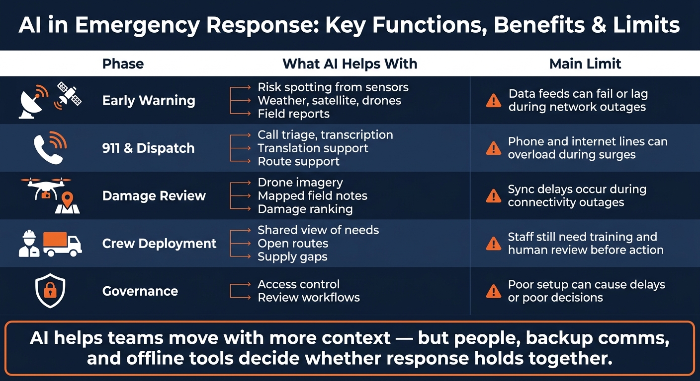
AI in Emergency Response: Key Functions, Benefits & Limits
How AI Will Impact Emergency Response: The Tech That Could Soon Save Your Life w/ Michael Chime
sbb-itb-20a3bee
How AI Predicts Risk and Supports Early Warning
AI-supported early warning systems pull sensor, radar, weather, satellite, drone, and field data into one shared view so EOCs can move sooner. That cuts some of the strain on manual reporting and overloaded call lines. But speed is the whole point here: early warning only helps if dispatch gets it fast.
Flood, wildfire, and storm forecasting using sensor and satellite data
For floods, wildfires, and severe storms, AI helps agencies sort through incoming sensor, radar, weather, and satellite data faster than manual review alone. That matters when conditions shift by the minute. Statewide interactive wildfire maps are already in use to give EOCs real-time updates on fire spread and resource demand.
There are still weak spots. Cellular and internet networks often fail or overload during major disasters, which can delay field data syncing. Backup communications can fill part of that gap, but some field tools still need manual input when connectivity drops.
Risk mapping for vulnerable neighborhoods and critical infrastructure
AI-supported mapping helps agencies see which neighborhoods and pieces of critical infrastructure face the most exposure. Field teams using tools like CalTopo can record exact locations, notes, and images in real time, or later when connectivity allows. That gives command centers a clearer picture as conditions keep changing.
In Washington, the Shoreline Auxiliary Communications Service used CalTopo in training, which allowed volunteers to send mapped field data to a communications van.
Comparison table: early warning strengths versus limits
| Strength | Limit |
|---|---|
| Live drone feeds and field observations provide immediate visibility into hazard progression | Cellular and internet networks often fail or overload during major disasters, delaying data sync |
| Tools like CalTopo allow precise, location-based reporting for more targeted alerts | Some field tools require manual input or delayed syncing when connectivity is lost |
| Centralized hubs aggregate weather, satellite, drone, and field data into one unified view | Managing multiple data feeds and communication lines requires specialized training |
Once risk is mapped, responders have to route crews and supplies in real time.
How AI Supports 911, Dispatch, and Live Operations
Once teams spot risk, the next job is simple to say and hard to do: sort calls and send help FAST.
In a major incident, 911 centers can get slammed with calls. AI helps organize incoming information, speed up context, and support dispatchers in the middle of that rush. But the final call still belongs to people.
Call triage, transcription, translation, and routine call handling
AI can transcribe calls, translate between languages, flag routine calls, and route urgent ones to dispatchers. That helps with triage and documentation when call volume spikes. Human dispatchers still keep final authority.
Routing ambulances, fire units, and field teams in real time
After triage, dispatch takes over. Live mapping can help dispatchers send ambulances, fire units, and field teams along the nearest open route. Shared maps and radio traffic also give dispatchers a clearer view of what’s happening on the ground as conditions change.
Comparison table: dispatch and triage uses versus operational risks
| Function | Operational Risk |
|---|---|
| Integrated communication hubs | Overloaded phone lines and disrupted internet access can render digital-only systems ineffective |
| Mobile operations hubs with live data feeds | These systems still depend on stable communications and working data streams |
AI works as decision support, not a stand-in for human oversight.
How AI Helps with Damage Assessment and Resource Deployment
Once calls are triaged and crews are on the move, AI helps teams figure out what was hit, how bad it is, and where people and supplies should go next. It takes post-incident imagery and field notes and turns them into damage maps and ranked task lists, so managers aren't stuck piecing things together from scattered updates.
Damage assessment from drone imagery
Drones and field-mapping tools can record damage in real time and sync that data to a central hub once connectivity comes back. That matters in a disaster, when signals drop and crews still need to keep working. Instead of waiting for every update to come through by phone or radio, teams can keep collecting on-site data and upload it later.
That same stream of imagery and field notes gives managers a clearer picture of conditions on the ground. If one area has blocked roads, downed lines, or heavy structural damage, they can see it faster and act with less guesswork.
Allocating crews and other resources
A shared data hub gives managers one place to review incoming reports, rank damage, spot bottlenecks, and assign crews and supplies faster. In plain terms, it helps answer the questions that matter most: What needs attention first? Who's closest? What equipment is missing?
When that information lives in one system instead of separate calls, texts, and handwritten notes, deployment gets more focused. Crews are less likely to be sent blind, and supplies can be routed where they'll do the most good.
Comparison table: AI-assisted methods versus manual response
| Factor | AI-Assisted Methods | Manual Response |
|---|---|---|
| Speed | Shows damage in real time via live feeds and mapped field notes | Slower; dependent on verbal reports and potentially overloaded phone lines |
| Connectivity dependence | Data recorded locally and synced once connectivity returns; mobile hubs add resilience | First to fail during a disaster due to network congestion |
| Decision quality | High; imagery and mapped data support faster decisions | Limited by the quality of radio or voice descriptions |
These gains depend on accurate data, secure systems, and human oversight.
Risks, Governance, and Key Takeaways
Those gains only matter if agencies protect sensitive data and keep people in charge. Once AI helps teams move faster, the next issue is control: who can see the data, who signs off on the action, and what happens if a system goes down?
Privacy, human oversight, and operational continuity
Field data is sensitive. In many cases, it includes private information, location details, and on-the-ground reports that can't be handled loosely. AI can help surface context and speed up review, but human responders should make the final decision.
Agencies also need a plan for connectivity failures. In the field, outages happen. That's why offline-capable tools matter: they let teams record data during disruptions and sync later when service returns.
U.S. public-sector guardrails for responsible AI use
A simple setup goes a long way. Use one access-controlled hub for live feeds and field reports, so staff aren't bouncing between scattered systems. Then train staff to review incoming feeds and approve actions before anything moves forward.
Comparison table: major AI risks and mitigation steps
| Risk | Mitigation |
|---|---|
| Fragmented information | Centralize feeds and field reports into one access-controlled hub |
| Overreliance | Human responders make the final decision |
| Connectivity disruptions | Use offline-capable tools that record data during outages and sync once connectivity is restored |
These controls matter because the main risks aren't abstract. They show up in the field as delays, lost trust, and broken continuity. AI can speed response, but secure data, human oversight, and offline continuity still determine whether it holds up when people need it most. AI helps improve emergency response here, but it does not replace human judgment.
FAQs
How accurate is AI during disasters?
AI can be accurate during disasters when it draws on varied, live data sources that help responders see what’s happening in a clear, dependable way.
The catch is that bad data is still a major problem. So agencies need regular audits, strong data governance, and human observations alongside verified sensor data to make AI output more useful and dependable.
What happens if networks go down?
During a disaster, communication networks are often among the first things to go. Phone lines get overloaded. Internet access drops out. And that makes it much harder for emergency teams to coordinate when every minute counts.
To keep work moving, responders rely on backup systems to record field data such as locations, notes, and images. If a connection is available, they send that information to a central hub in real time. If not, they store it and sync it later when service comes back.
That way, teams can keep collecting and sharing critical situational data even when the main network is down.
How should agencies keep humans in control?
Agencies should put human oversight first so emergency response decisions stay ethical, transparent, and in line with what the public expects.
AI should support human judgment, not replace it. That matters when teams need to deal with bias, make sense of high-pressure situations, and keep trained professionals in control while using technology to collect information and speed up response work.